Archeological high technology maps hidden ancient societies
Head of center Rubina Raja, from the Center for Urban Network Development (UrbNet), in collaboration with colleagues from the Danish-German research team Northwest Quarter Project, has reconstructed ancient society using aerial photos and 3D scans.
In the famous Decapolis city of Jerash, Jordan, Professor Rubina Raja, who is the head of the Centre for Urban Network Evolutions (UrbNet) at Aarhus University, together with colleagues from the Danish-German research team Northwest Quarter Project, has mapped hidden ancient societies using new high-technology methods. The new methods mean that the research group can map landscapes and unseen archeological and non-archeological artifacts with accuracy and precision.
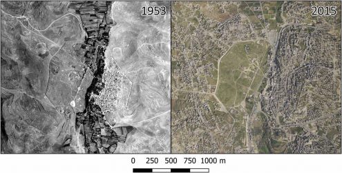
What is new about the method is that it integrates aerial photography from the First World War with more recent aerial photos and modern technologies such as 3D scans. When the researchers compared all three items with archeological finds and historical pictures, they were able to turn back time and create a detailed reconstruction of the landscape and the ancient city of Jerash. Through this non-invasive research method, the researchers can document archeological artifacts that are no longer visible because of the city’s later development and modern urbanization.
Using this method, the researchers identified hitherto unknown infrastructure such as aqueducts, canals, water springs, and cisterns. The researchers then compared their findings with the city’s water supply areas of today. The comparison indicates that water management in Jerash has undergone massive changes, partly because of changes in the patterns of habitation and ways that past inhabitants managed the land and partly because of climate factors. These changes are often dated back to around the 8th century (AD), but according to the research group’s data, the changes were already under way several centuries earlier than previously estimated.
Read the research article in PNAS here.
Further reading about UrbNet and their research can be found here.
A brief overview of Jerash
Jerash was an important city in the Byzantine Empire, and the city’s monuments and structures show that Jerash was a lively and active place. The ancient city covered an area of approximately 90 hectares, surrounded by more than 4 kilometers of a city wall. In 749, the city was destroyed by a massive earthquake and a wealth of archeological material was lost. After the earthquake, Jerash faded, and it was not until the early Islamic period in the 12th century that the city was inhabited again.
Since the first major excavations in Jerash in the 1920s and 1930s, the city has been explored and studied numerous times, but large parts of the city remain unexplored. The researchers are working against time, since the city is threatened by destruction because of modern development around the location.